click the pics for a much better view
 We left from Bull Run Farms around 8:30 AM and traveled about 45 minutes to a small village called Antoino. There we met a caravan of about a dozen other vehicles at the Military Police Headquarters and were escorted on the 22 mile trek on the sometimes rocky, sometimes paved, but mostly dirt road to Caracol. Caracol is an ancient Mayan city (circa 400 - 1200 AD) that was discovered in 1937 by a logging crew. Excavation began in the 1950's and continues to this day. It is estimated that Caracol covers an area of 177 square kilometers and has recently been aerially mapped by some new laser technology called lidar (light based radar). At the center of the city is a series of palaces where the rulers of Caracol lived and where the Mayans conducted business and worshiped their gods. Tikal is another Mayan city located about 70 kilometers to the northwest in Guatemala and was once thought to be the largest of the Mayan cities. Tikal ruled the Mayan world until the 5th century. There were constant wars between the two cities. But the records of Caracol indicate that Caracol conquered Tikal in 562AD.
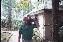
The pyramids of Caracol are unique. They include living quarters on top for the ruling families and burial chambers on the bottom. The steps up to the top are about 18 inches high each so they are difficult to climb. Obviously climbing to the top of the pyramids was designed to be difficult. This was for two reasons. First the pyramids were considered temples and ascending one is like ascending toward their god. The journey was made difficult so that one could earn the right to approach their god. Second, the pyramids were a last line of defense in wars and so it was designed to make it difficult for the enemy to ascend as well. The pyramid featured in the picture above is about 300 feet tall. I find it interesting that the tallest building in the country of Belize is 1500 years old.

Being a forester I was fascinated with the trees in Caracol. To the south of the main palace was a 100 foot tall tree called a Hog Plum. It stood out because of its beautiful crown and bright green leaflets. It produces a plum like fruit that has a unique sweet but tart flavor. We saw quite a few stranglewood trees. It is an invasive tree in that it starts as a vine that grows up the trunk of another tree. The vine then spreads around the trunk of the tree over time eventually "strangling" it. It then uses the trunk of its host as support. Ss the host tree dies, the stranglewood tree begins growing up like a full tree using the host's trunk as a foundation for support. Then there is the huge Ceiba tree (click the picture to the right to see Landra). There were three at Caracol. The largest of the three had a swollen trunk about 30 feet in diameter that rose up about 15 feet to a very straight and 150 foot tall tree with 12 foot diameter trunk and a crown that spanned at least 200 feet wide. It is massive. Being the tallest and largest of trees in the forests of Central America, the Ceiba was sacred to the ancient Mayan culture. Even today Mayans do not log the Ceiba in respect for their ancestral culture.
 After touring Caracol and climbing most of the pyramids, we ate lunch at the Welcome Center, bought some souvenirs, and traveled back to Antoinio. The road to Caracol and back crosses the Macal River. It is the second largest river in Belize. We crossed the river on a bridge that is rather scary looking. It is a concrete bridge about 100 yards long that has no guard rails. I looked down the river and remember watching on TV The Crocodile Hunter, Steve Irwin, wading the Macal River in search of Crocs and Fer de Lance, one of the most dangerous snakes in the world.
We checked back in at the police headquarters and told them we wanted to go to the Rio Frio Caves. We were given a military escort there. When asked why we were told that bandits from Guatemala had robbed a few tourists last year and since tourism is so important to the Belize economy the government felt it necessary to give escorts to all tourists. So off we went (about 1 mile away) to the Rio Frio cave escorted by a guard armed with an M-1 rifle. The Rio Frio Cave is absolutely breathtaking. The openings are over 70 feet tall. The cave is 1/4 mile long and there is a trail that allows you to walk all the way through it. The cave is carved out of limestone rock by a relativ
 ely small creek. The features include a sandy beach about 200 feet inside and lots of neatly colored rock formations. Belize has thousands of caves all over with the Rio Frio cave probably being the most beautiful. It alone makes the trip to the Mountain Pine Ridge worthwhile. We said goodbye to our military guard and drove back towards Bull Run Farm. On the way we made a brief stop at the Rion Pools. These are natural pools carved out of a tributary of the Macal River where tourists and locals can swim. We did not bring out swimsuits so we did not stay long but Landra got to take some more pictures....she seems to truly love to do that. She found a carving in a rock of an ancient Mayan head which she thought was neat. I explained it was probably a local's carving, not a real ancient carving. She took a picture of it anyway.
 It was approaching 3 in the afternoon so we continued the drive back to Bull Run Farm and out to Hidden Valley Falls, aka 1000 Foot Falls. There are about a dozen waterfalls on the Bull Run Farms and Hidden Valley Inn properties. Hidden Valley Falls is the second most spectacular one in my opinion. I hope to blog about the most spectacular one tomorrow. This waterfall was once the property of Bull Headley. About 20 years ago Bull opened the Hidden Valley Falls up to the public as he was developing the Hidden Valley Resort. It gained notoriety as a great place to view not only the falls, but the mountain view and the birds who inhabit the area. Belize is a bird watcher's paradise featuring 540+ species of birds with the Mountain Pine Ridge being home to over half of them. One of the four major waterfalls on the Hidden Valley property is called King Vulture Falls, named after one of Belize's largest birds. Anyway, in 1998 the government of Belize decided that Hidden Valley Falls was a national treasure and decided to acquire it, although Bull did not really want to part with it. The Belize Constitution is based upon British Common Law and the government has the power of eminent domain so it can seize any property it wants for the public good. However, just as in the states, Belize must compensate the owner of the property at its fair market value. But just what is fair market value of a 1,600 foot waterfall and how does a government with no money pay for it? Those were the questions that kept the transfer in dispute until 2002 when Bull and the Belize Interior Dept. agreed to swap the falls and the surrounding 1,200 acres of land, which was mostly escarpment, for 6,000 acres of pine timberland plus some money to reimburse Bull for the buildings he had built on the site. The transfer was completed about a year later.
We arrived at the falls and were greeted by Pedro who has been the caretaker of the Hidden Valley Falls overlook since well before I first came to Belize in 1997. He remembered me and we talked for a moment. Then I took Landra down a long flight of stairs to a concrete platform built over the escarpment that gives the spectacular view shown above. She was amazed at how beautiful it looked. I pointed to a trail along the top of the ridge that runs from Bull Run property that would take you to the top of the falls. But there isn't much to see except for creek rapids because the water drops straight down. We took lots of pictures and a video and watched God's handiwork on display for a long while. I don't think Landra was expecting what she saw as she kept saying "This is amazing". She had asked about treking to the bottom and I told her the story about how several years ago the British military planned an exercise to repel down to the bottom and travel down river to Georgetown, about 18 miles away. Bull Headley found out about it. Since the falls were on Bull Headley's property at the time, Bull went to the group on the morning of the descent where he reminded them they were on private land. A Colonel met with Bull explained their plans to hike from the bottom to Georgetown. Bull said clearly "are you sure you want to try that?" The Colonel said "yes" and assured Bull that they would not hold him liable or accountable in any way. Bull agreed. Three days later the platoon radioed for help. The British sent in a helicopter to pull them out. In three days they had made it only 3 miles of the 18 mile trek. That is how treacherous the Roaring Creek bottom of Hidden Valley Falls is.
Around 4:30 we started back to the farm where Melina was preparing supper. George joined us shortly afterward. Then we sat and enjoyed a meal of baked chicken, home fires, salad, and key lime pie for dessert. It was a truly wonderful day filled with exploring ancient history and God's beautiful creation and celebrating Landra's birthday.
Today I will spend the day training some of George's men on how to properly do a pre-commercial thinning in the pines. Landra and Melina will probably go for a swim in Peter's pool. Later this afternoon we hope to make a trip to Hidden Valley's most spectacular waterfall, Butterfly Falls. I will report on it tomorrow.
No comments:
Post a Comment